The Best 7 Hikes In Shenandoah National Park
Established in 1935, Shenandoah National Park encompasses over 170,000 acres and is located in a part of the Blue Ridge Mountains of Northern Virginia. Situated on a long, narrow piece of land, it can be accessed via the main road called Skyline Drive. Spanning 101 miles from North to South, Skyline Drive is filled with over 500 miles of hiking trails, an abundance of waterfalls, incredible wildlife, and plenty of wildflowers.
With beautiful scenic overlooks, breathtaking waterfalls, and rugged rock formations hiking in Shenandoah National Park is a hiker’s delight. We’ve put together a list of the top 7 hikes offering the best views and how to navigate through the park.
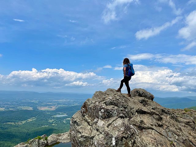
1. Old Rag Trail
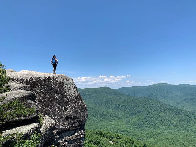
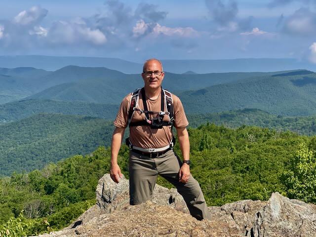
The Old Rag Trail was our absolute favorite all-time hike in Shenandoah National Park. We loved this hike because of the picturesque views and the challenges incurred as we wandered up the trail through a beautiful forest and maneuvered through boulders to reach the peak. At 3,268 feet, the summit offers 360-degree views and is AMAZING. Before starting, be aware that this hike is long and strenuous but is well worth every aching step from the bottom of your soles.
Be prepared with plenty of food and water. At least 2-3 liters of water per person and plenty of snacks. When choosing snacks, find things high in carbohydrates and protein that are light and easy to carry. A couple of my favorites are apples, oranges, and almonds.
Know before you go: Due to increased popularity and the fragile environments, an Old Rag Trail Pass is required to hike this trail. The cost is $1.00 per person, and a reservation is required from March 1 – November 30. You can get more information and make your reservation at recreation.gov.
- Distance: 9.2 Miles (round trip) or
- Difficulty: Very Strenuous
- Elevation: 3,268 feet
- Time: 8 hours
- Location: This hike is not on Sky Line Drive. You must leave the main road and take US-211 to Sperryville.
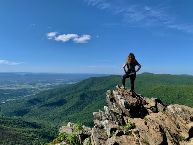
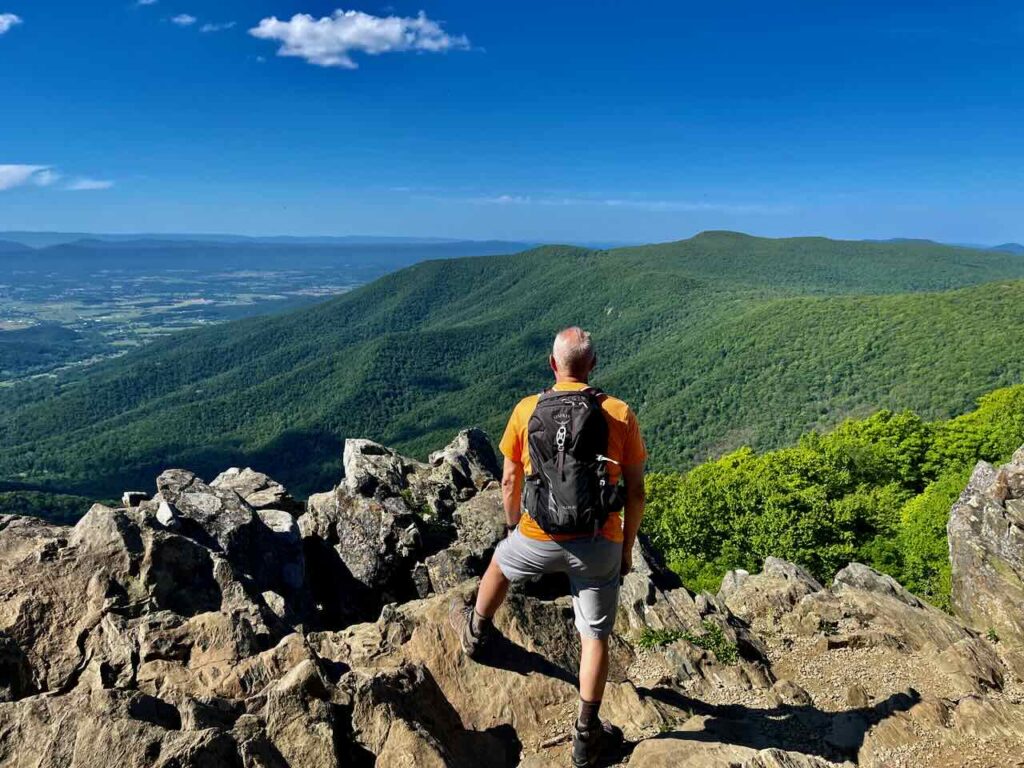
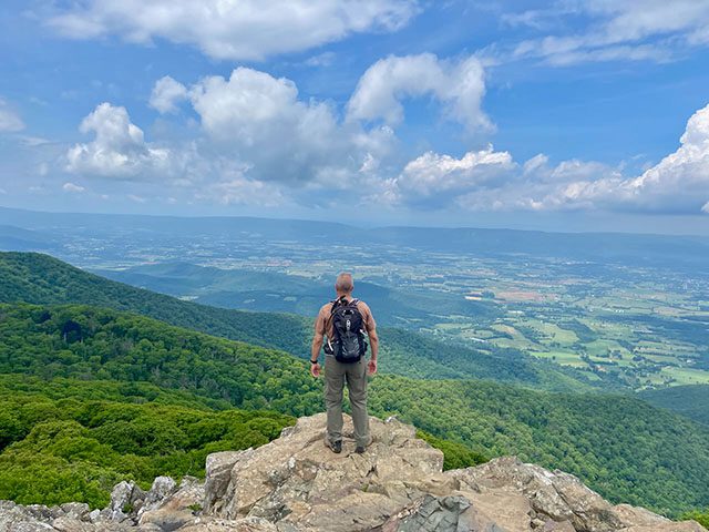
2. Hawksbill
Another one of our favorite hikes in Shenandoah National Park happens to be the TALLEST PEAK in Shenandoah National Park. As you stand on top and gaze over the edge, you will be standing at an elevation of 4,051 feet. Although a steep climb, we love this hike as it wanders through a thick forest, offers plenty of beautiful views, and can be hiked as a loop or an out-and-back trail. We suggest taking the loop rather than the out and back path. It is a bit longer, but not as steep as the out and back, and offers better scenery.
- Distance: 2.8 Miles loop
- Difficulty: Moderate
- Time: 3-4 hours
- Location: Mile Marker 45.6 (parking is on the west side of the road).
Insider Tip: When starting your hike, we suggest going counter-clockwise from the Hawksbill Gap parking lot, which will twist around the mountain and spread the elevation gain over a longer distance on the way up.
In the counter-clockwise direction, you will see a fork in the trail after a few minutes of walking. As you continue, stay to the left and look for the cemented markers to help guide you on the track. You will keep to the left as you hike to the top.
3. Little Stony Man
Looking to find an easy hike with a scenic view? Little Stony Man trail is an excellent easy hike with an abundance of Mountain Laurel and wildlife by your side. When reaching the summit you will get a wonderful view of Page Valley.
- Distance: .9 miles (out and back)
- Difficulty: Easy
- Time: 1 Hour
- Location: From Mile Marker 35.9 (small parking lot on the west side of the road). This is the shortest path to Little Stony Man. You may also enter from Mile Marker 41.5 located at the Skyline Drive Corridor this will add an additional 1.1 miles.
Insider Tip: After spending time at the Little Stony Man Overlook, you can continue on the trail to also capture the beautiful Page Valley at the Stony Man Overlook. This will make the hike approximately 3.0 miles (out and back).
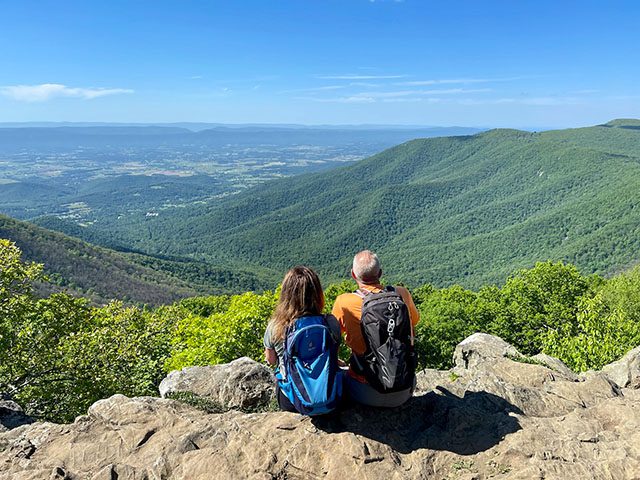
4. Stony Man
At 4,020 feet, Stony Man is the second most prominent peak in Shenandoah National Park. It is an easy hike and allows you to get a two-for-one deal on views since this trail will also lead you to Little Stony Man Peak.
Access the hike via the Appalachian Trail (also known as the infamous AT) from the Skyland Visitors Center Corridor area. The Skyland Visitors Center Corridor area is an excellent mid-point of the park that offers a full-service restaurant, lodging, a gift shop, and a fantastic taproom.
- Distance: 1.9 miles (out and back)
- Difficulty: Easy
- Time: 1 hour
- Location: Mile Marker 41.5. From Skyline Drive access via the Skyland Upper Loop Road (located in the Skyland Visitors Center Corridor)
Insider Tip: After hiking to Stony Man, you can continue North on the AT trail for 1/2 of a mile to see Little Stony Man. This would make your total out and back 3.0 miles.
5. Dark Hollow Falls
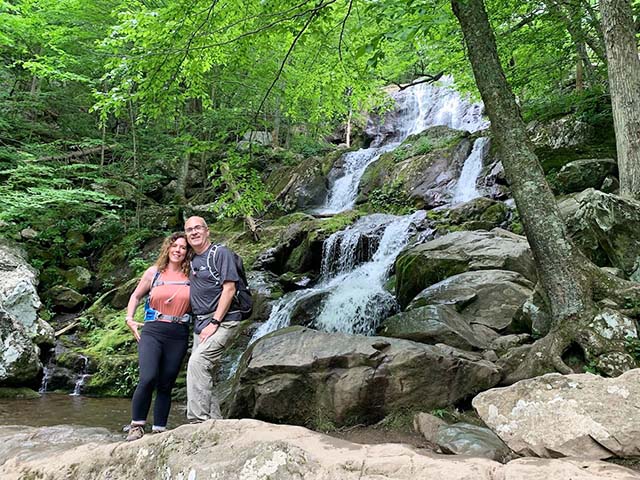
Dark Hollow Falls is a stunning 70-foot cascading waterfall that is created from Hogcamp Branch. It is a family-orientated hike that descends to the falls.
Although the trail is short, this descending trail has many areas that have eroded due to high traffic. We suggest you leave extra time for the descent down to the falls, and of course, to gaze at the view. Considering the terrain, it is merely a steep walk rather than a hike.
When you arrive at the falls make sure you pop your head around the trees. Part of the cascading falls is tucked around the corner and cannot be seen from the sideline of the trail. But please, as always, stay on the trail and leave no trace.
Once you have taken in the scenery, it is well worth your time to continue down the trail for .3 miles to the steel bridge. There are three more falls that can be viewed.
- Distance: 1.4 miles (out and back)
- Time: 1-2 hours
- Difficulty: Easy-moderate (elevation change of 440 feet)
- Location: Mile Marker 50.7
Parking Tip: This hike is very popular, and parking fills up very fast. If you are out of luck on parking, head north on Skyline Drive. There is also parking and a trail at mile marker 49.4 (Fishers Gap Overlook Parking is located on the west side of the road). The trailhead is across the road from Fishers Gap parking.
6. Bearfence Mountain
Another splendid hike that offers panoramic views is Bearfence Mountain, at over 3,600 feet. This is another family-orientated hike where you can view Shenandoah Valley to the West and Bluff Mountain to the East. No matter where you look, you will have a fantastic view. The hike starts with a wide uphill trail and then proceeds through a rocky terrain requiring a small amount of rock scrambling to get to the top.
- Distance: 1.2 miles out and a loop back.
- Time: 1 -2 hours
- Difficulty: Easy – Moderate
- Location: Mile Marker 56.4
HINT: Once you hit the rocks, follow the blue lines to find the trail path. You will be hiking on a sheath of rock, and the lines help you stay on track.
7. Black Rock Trail
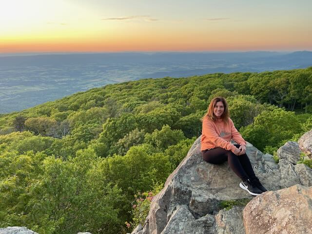
Are you looking for a great view of the sunset? Black Rock Trail is a short but sweet hike. This leisurely hike is at an elevation of 3,720 feet and offers a view of the entire west valley. To find the trailhead go past Big Meadows Lodge and park near the cabins.
- Distance: .4 miles out and back
- Time: 30 minutes
- Difficulty: Easy
- Location: Mile Mark 51.2, at the Big Meadows Lodge.
Insider Tip: The Big Meadows Corridor is an excellent place to take a break. There are several places to eat including a grab-and-go snack bar, a full-service restaurant, and a taproom in the Big Meadows Lodge. The Corridor area also has a gas station, souvenir shop, a fast-food Restaurant, and a National Park Visitors Center for information.
Searching for another awesome place to hike? Check out our post on “Hiking in the Great Smoky Mountains National Park.”