Hiking in the Great Smoky Mountains National Park

A playground filled with an abundance of mountain views, gorgeous waterfalls, and trickling creeks scattered amongst the lush green forests, the Great Smoky Mountains National Park is one of our favorite parks to visit. The park which spans Tennessee and the west border of North Carolina was established in 1926 and covers approximately 522,420 acres of land.
Being one of the most visited National Parks in the United States, it is amazing how easy it is to navigate through the park. It does not feel as congested as others parks we have visited. We have visited this park dozens of times and in this article you will find our top best all time hikes.
Top Hikes in the Great Smoky Mountains National Park
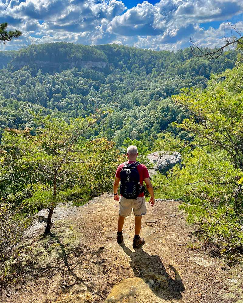
1. Hike Charlies Bunion Trail
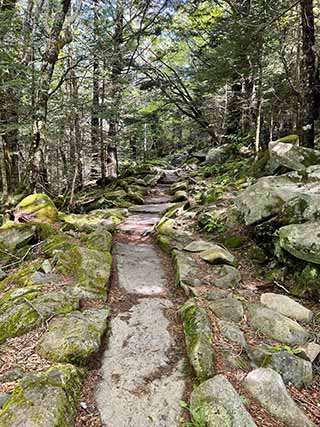
By far, one of the top hikes of the Smoky Mountains is the overlook located on Charlies Bunion Trail. You will see some of the most spectacular views of the Smoky Mountains National Park from the overlook.
- Distance: 8 miles (round trip), this is an out-and-back trail
- Difficulty: Strenuous
- Elevation change 1650 feet
- Time: 4-5 hours
Directions:
Driving: From the Sugarland Visitor Center, follow the Newfound Gap Road southeast for 13 miles and turn left into the parking lot. In fact, the drive itself is beautiful as you will pass by many pull-offs with beautiful overlooks. There is a great chance you will see deer, and possibly a bear or two.
Hiking Trail Directions: This hike starts from the parking lot and will follow the Appalachian Trail (also known as the AT) trail. During the first 2.5 miles, the trail will be ascending and filled with wildflowers and fir trees and will have a few openings with some amazing views.
As you approach the fork, you will want to stay to the right to continue to the Charlies Bunion overlook, otherwise, the left trail is one of the many ways to Mount Leconte. As you continue you will pass by a really cool shelter that is worth a few minutes to check out. After the shelter, there is a rocky descent, but remember…what goes down must come up. The trail will then ascend up to the Charlies Bunion overlook.

Insider Tip: If Charlies Bunion is crowded, continue down the trail for just a couple of minutes and there will be a beautiful opening for pictures and place to rest and have your lunch.
2. Hike Andrews Bald Trail
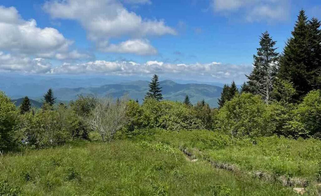
To start the hike, you will be wandering through a thick forest filled with rugged large boulders, you will continue on the path through Fraser firs and dainty wildflowers, and last but not least this hike will open up into a grassy field. When you cross paths with a balance beam and see tall grass you are close to the overlook. It is definitely filled with beautiful scenery and will put your heart at peace as you travel with soles to Andrews Bald Outlook.
- Distance: 3.6 miles round trip (this is an out-and-back trail)
- Difficulty: Easy-moderate
- Elevation change: 850 feet
- Time: 3 hours
Directions:
Driving: From the Sugarland Visitor Center, follow the Newfound Gap Road southeast for approximately 13 miles and turn left onto Fighting Creek Gap Road, and then turn right onto Clingmans Dome Road for another 7.1 miles. There will be a large parking area that is also where the parking for Clingman’s Dome.
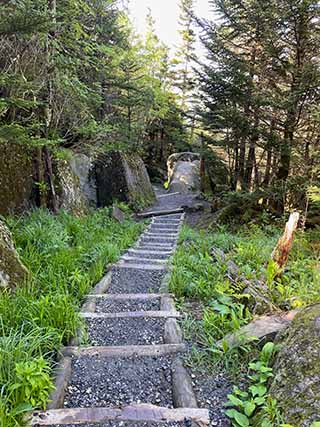
Hiking Directions: From the Clingman’s Dome Visitor’s parking lot, head towards Clingman’s Dome trailhead. When you get to the fork where the pavement starts to walk up to Clingman’s Dome, take a left down the stairs made of rock on the left. There is a sign located at the beginning of the trail.

Insider tip: It is best to hike this trail in the morning. Thundershowers are typically in the afternoon and the fog creates low visibility. Be extremely cautious if it rains because the stairs and rocks get very slippery.
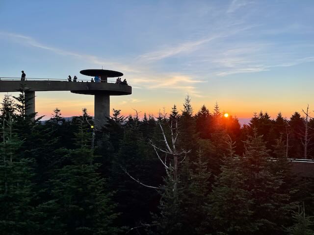
3. Hike to the top of Clingmans Dome
Clingmans Dome boasts the highest peak in the Smoky Mountains at an elevation of 6,643 feet and is an absolutely gorgeous sunrise and sunset. Although this trail is relatively easy, the steep incline will leave you gasping for air. But have no worries, there are a few benches along the way to take a quick break to rest if needed.
- Distance: 1.2 miles roundtrip (this is an out-and-back trail)
- Difficulty: Easy-moderate (the steep incline for a short distance)
- Elevation Change: 331 feet
- Time: 1 hour
Driving: From the Sugarland Visitor Center, follow the Newfound Gap Road southeast for approximately 13 miles and turn left onto Fighting Creek Gap Road, and then turn right onto Clingmans Dome Road for another 7.1 miles. There will be a large parking area that is also where you will start your hike for Andrews Bald Trail.
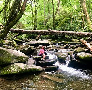
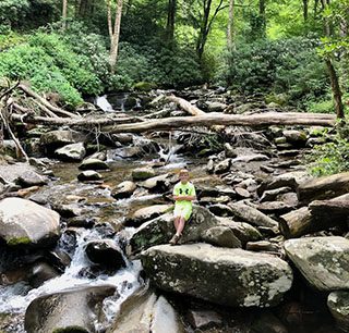
4. Hike the Chimney Tops Trail

As the trail winds up the mountain, it follows a beautiful creek bed full of giant boulders, wildlife, and wildflowers. It is one of the most peaceful hikes in the park and is full of beauty throughout the entire hike.
 Creek along the trail
- Rhododendron flower
- Creek along trail

- Distance: 3.2 miles round trip
- Difficulty: Moderate
- Elevation Change: 1480 feet
- Time: 3 hours
Directions: From the Sugarlands visitor center inside the National Park take 441 (New Foundland Gap road is approximately 7 miles) The trailhead parking is right off 441.
Beloved by hikers, this trail has been forever changed since the 2016 wildfires. My heart is still saddened but I have had the honor of hiking this trail prior to and after the wildfires. The trails forever program, which is a partnership between the National Park Service and a non-profit organization Friends of Great Smokies National Park opened the trail back up in 2020.
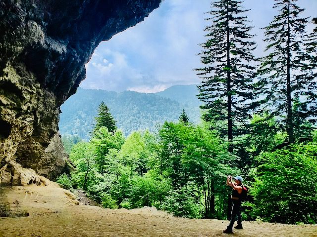
5. Hike to Mount Le Conte – Via Alum Bluff trail
There are so many gorgeous things to see along the way including a trickling creek that you must cross via a handmade log with a handrail, wildflowers, the alum bluff cave (which really isn’t a cave although beautiful), great overlooks, and if you are lucky a black bear.
- Distance: 10 miles total (out and back).
- Difficulty: Strenuous
- Elevation Change: 2800 feet (Peak of 6,593 feet)
- Time: 8 hours
Directions: From the Sugarlands visitor center inside the National Park take 441 (the New Foundland Gap Road) for approximately 11 miles. The trailhead parking is right off 441.
Insider Tip: BE PREPARED for a very strenuous hike. It is important that you are prepared and that you have the proper footwear, food, and water. We suggest that you have a sturdy hiking shoe or boot. A few great trail food choices are protein bars, apples, oranges, nuts, and trail mix for each person on the hike.
6. Hike Grotto Falls Trail
Scattered throughout the park are over a hundred waterfalls which all have their own unique characteristics. We find ourselves visiting a select few because of their beauty versus time. We like to take in as many things as we possibly can and Grotto Falls is worth the visit. You will want to add this to your bucket list of waterfall hikes.
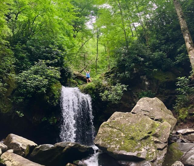
Grotto Falls is a family-friendly hike located just outside of Gatlinburg.
- Distance: 2.8 miles (out and back)
- Difficulty: Easy-moderate
- Elevation Change: 580 feet
- Time: 4 hours
Directions: From the town of Gatlinburg take traffic light #8, which is Cherokee Orchard Road. It will eventually turn into a one-way road and you will follow Roaring Fork Motor Trail. You will pass by Rainbow Falls trailhead, Baskins Creek Trailhead, and will drive until you see the Grotto Falls/Trillium Gap Trailhead.